Boating From Las Olas Isles: Routes, Marinas, And Access
April 16, 2026
April 16, 2026
If you live in Las Olas Isles or you are considering buying there, boating access is not a lifestyle detail. It is a core part of how you use the property. The difference between an easy lunch run, a smooth Intracoastal cruise, or a more complex offshore departure often comes down to route planning, bridge clearance, and marina positioning. This guide breaks down how boating from Las Olas Isles actually works, what to verify, and which nearby marinas and stops matter most. Let’s dive in.
Las Olas Isles sits inside one of the most active boating networks in South Florida. According to Broward County boating resources, the county has more than 300 miles of navigable waterways, and the City of Fort Lauderdale notes 165 miles of local waterways with public municipal docking and launching sites.
For practical planning, boating from Las Olas Isles usually moves through three environments. You start in sheltered residential canals, then transition into the busier Intracoastal Waterway or New River corridor, and finally reach Port Everglades if you are heading offshore. That route structure aligns with NOAA Coast Pilot guidance for Fort Lauderdale, which identifies New River as the area’s main navigation channel and describes the city’s mix of canals and natural waterways.
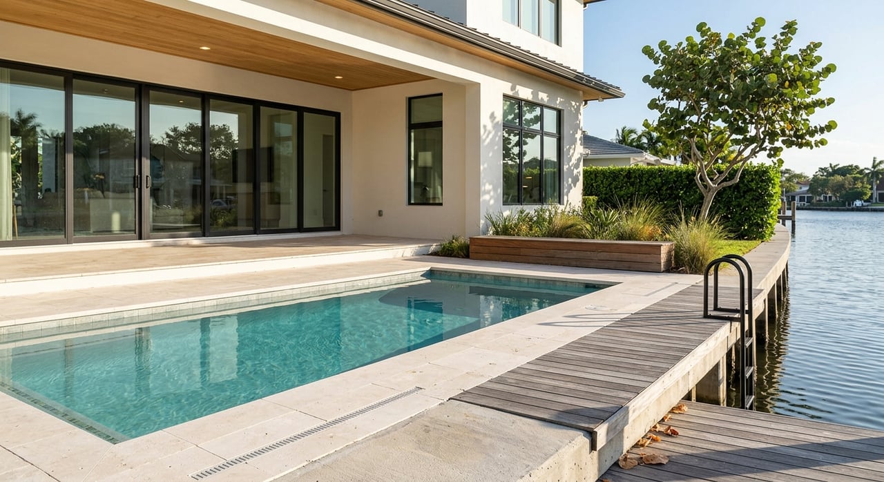
In waterfront real estate, the boating story is never just about having a dock. It is about how efficiently and safely you can move from your slip to your intended destination. For buyers, that means verifying the exact bridge path, berth depth, slip length, and whether your boating pattern will mostly involve canals, the ICW, or New River.
This is especially important in Las Olas Isles, where route convenience can vary based on your vessel height and draft. A shorter day boat, center console, or cruiser may have far more flexibility than a taller yacht that must account for fixed bridge clearances on every trip.
Most offshore trips from Las Olas Isles funnel into the Intracoastal Waterway and then continue toward Port Everglades. In practice, the inlet is the key timing point for anyone planning to run out to sea.
According to NOAA Port Everglades guidance, the Port Everglades A1A bridge over the inlet has a 13-foot clearance, and current past the bridge can reach 5 to 6 knots on the flood. NOAA also notes that local knowledge is recommended, which is a meaningful point if you plan to make regular offshore runs.
For many owners, the single biggest boating variable is not the canal behind the house. It is the combination of bridge clearance and current at the inlet. Broward County’s Safe Boating Guide also reinforces that bridge-clearance figures are only a guide and should not replace navigation judgment.
That is why serious boaters should pair neighborhood familiarity with official charts and current conditions. If offshore access is central to your purchase criteria, this should be part of your upfront property evaluation.
If your typical boating day involves marina stops, waterfront dining, or a cruise north or south, the Intracoastal Waterway is often the most forgiving route. Compared with the inlet or the tighter bridge sequence on New River, the ICW offers a more straightforward path for many vessels.
NOAA’s Fort Lauderdale section places the Las Olas Boulevard bridge at 24 feet at the center. Moving along the corridor, Sunrise Boulevard is listed at 25 feet, Commercial Boulevard at 15 feet, and Oakland Park Beach Boulevard at 22 feet.
This route puts several useful stops within easy reach. NOAA notes that Bahia Mar is about 0.4 mile south of the Las Olas Boulevard bridge and offers 7 to 14 feet alongside the wharf, plus fuel, water, electricity, showers, ice, a restaurant, and marine supplies.
For many Las Olas Isles owners, that makes Bahia Mar one of the most natural short-hop destinations. It is close, well positioned, and connected to the broader marine corridor that supports dock-and-dine runs and marina services.
If you head toward downtown, New River becomes the main navigation channel. NOAA describes this stretch as narrower and more urban, with strong currents and heavy traffic at Tarpon Bend. It also notes that speed on New River is limited to no wake.
This matters because New River boating is less about open cruising and more about controlled navigation. It can be a very useful route, but it requires more bridge awareness and closer attention to traffic patterns.
Above the river junction, NOAA bridge data for New River lists:
For owners of taller vessels, this route can quickly become restrictive. For others, it remains a convenient way to reach downtown dockage and riverfront destinations.
Choosing the right marina depends on how you use your boat. Some owners prioritize proximity, while others care more about offshore convenience, service capability, or avoiding bridge restrictions.
The City of Fort Lauderdale lists Las Olas Municipal Marina at 240 Las Olas Circle. The operator site markets 88 slips for vessels up to 315 feet, along with direct Atlantic access and on-site dining.
For Las Olas Isles owners, this is one of the most visible nearby docking options. Its location and scale make it especially relevant for larger vessel owners who want a premium marina close to the neighborhood.
The City says New River/Downtown Docking sits on the banks of the New River just off Las Olas Boulevard and offers 100 slips with full utilities. It also places boaters within walking distance of shops and cafés.
This is a practical choice if your boating pattern includes downtown access and riverfront convenience. It is less about open-water staging and more about being close to the urban core.
Cooley’s Landing Marina is another public facility listed by the City, with boat access, a ramp, marina connections, waterfront walkways, and complimentary pump-out service. The City’s broader marine facilities information states that these public facilities are first-come, first-served.
That can be useful if you want public access options nearby, especially for planning, overflow, or launch-related needs.
Pier Sixty-Six Marina offers 5,000 linear feet of dockage and 164 slips for vessels up to 400 feet. The operator also notes zero bridge restrictions and describes it as the first marina on the right after entering Port Everglades from the Atlantic.
For larger yachts or owners who prioritize efficient ocean access, that positioning can be compelling. In strategic terms, it reduces one layer of route friction.
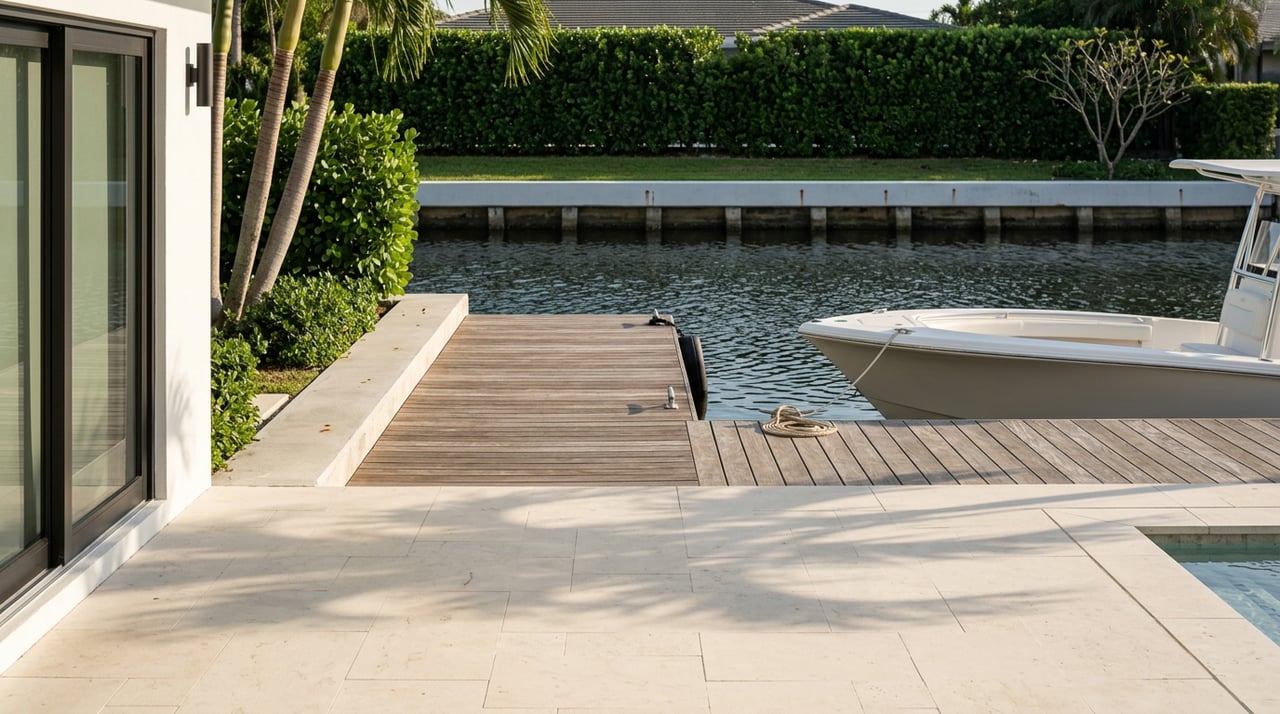
One of the biggest advantages of Las Olas Isles is that you do not need a long run to enjoy the water. Several nearby destinations support easy boat-to-table outings.
The clearest boat-first dining stop in this corridor is 15th Street Fisheries, which offers dockside dining and sits inside Lauderdale Marina at 1900 SE 15th Street. The same corridor also includes Coconuts, which says boaters can raft at its dock, and Boatyard, which advertises dock-and-dine reservations with both a slip and a table.
These short-run destinations are part of what makes Las Olas Isles so functional for day-to-day waterfront living. You can turn a quick afternoon cruise into a practical dinner plan without committing to a long route.
If you want public launch or dock options nearby, Fort Lauderdale offers several. The City lists George English Park, the SE 15th Street launch, Cooley’s Landing, Las Olas Municipal Marina, and other marine facilities in its municipal marine directory.
For route planning and local movement, Water Taxi stops and route information can also help you understand the practical boating network through Las Olas, 15th Street Fisheries, Pier Sixty-Six, Bahia Mar, and points farther north. The City’s LauderGO! Water Trolley also runs daily along the New River, though delays may occur during bridge operations.
If you are evaluating a Las Olas Isles property, boating access should be underwritten with the same care as the real estate itself. A beautiful dock line does not answer the operational questions.
Here is the short checklist to verify before you assume a property is a fit:
This is where local waterfront knowledge matters. In Las Olas Isles, the right property is not only about frontage. It is about matching the asset to how you actually boat.
If you are weighing a purchase, sale, or redevelopment decision on the water, working with an advisor who understands route friction, vessel fit, and neighborhood-specific constraints can help you avoid expensive assumptions. To discuss Las Olas Isles waterfront opportunities with a strategy-first lens, connect with Giulio Milano.
Stay up to date on the latest real estate trends.
Rooted in trust, expertise, and sincere dedication, Giulio brings a lifelong appreciation of what “home” means to every client and every move.